


WIND & WEATHER FORECAST
MALCESINE, LAKE GARDA
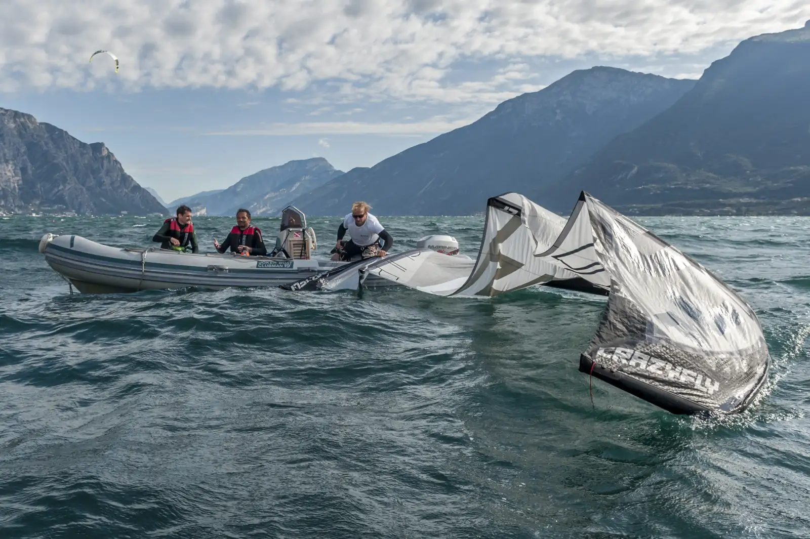
How is the wind?
Lake Garda’s weather is truly unique, and no forecast model can fully capture its complexities. While the following charts and models have the highest chance of accuracy, please remember they are only reference points—not proven forecasts.
Our best advice? Look outside. If you see white foam on the waves, it’s the clearest sign: the wind has arrived.
Pressure/Foehn Diagram
Works best for Pelèr (north wind)
The strength of the Pelèr and Ora winds can be gauged by the pressure difference, measured in hectopascals (hPa), between Bolzano and Brescia/Ghedi.
Pelér occurs when air pressure is higher in the north than in the south. The greater this pressure difference, the stronger Pelér blows over northern Lake Garda. Conversely, if the pressure difference is reversed (with higher pressure in the south), the south wind Ora takes over.
In practical terms, when a pressure difference of about -3 hPa is forecasted, we can expect around 20 knots of Pelér.
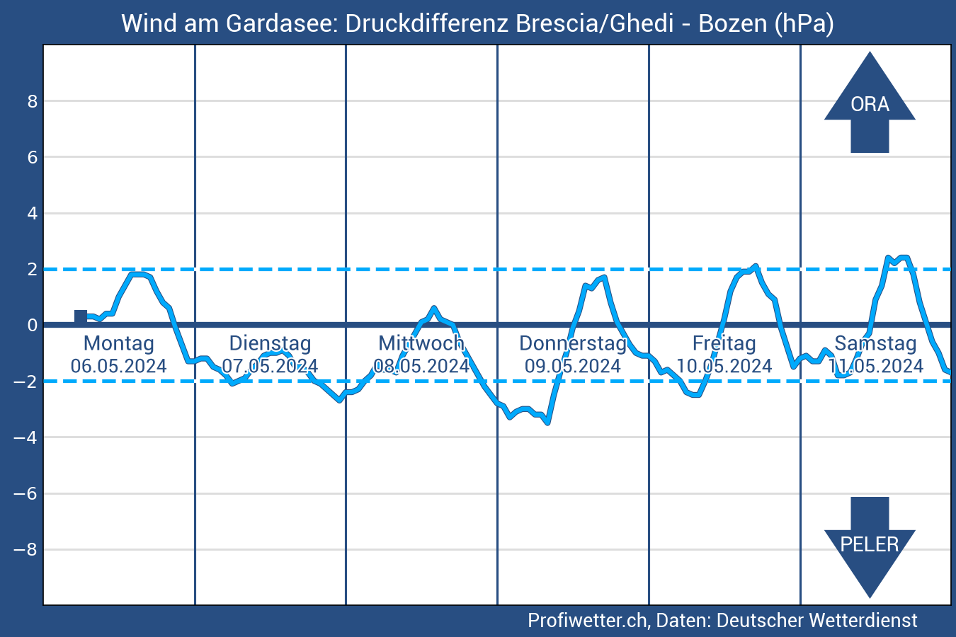
With friendly permission of Profiwetter.ch
AROME 1.3 km
This French model provides very detailed short-term forecasts, capturing local effects like thermals and valley winds, making it very accurate for predicting the Ora and Pelér. It’s currently one of the most reliable models for Lake Garda.
The chart shows north-wind as an arrow pointing to the bottom and south-wind the other way round. To estimate the real wind on the water, simply add about 5 knots to the gusts. That gives you a good idea of the actual wind strength you'll feel.
With friendly permission of Windguru.cz
Meteotrentino COSMO2
The forecast shows the average wind speed in meters per second (red) and the wind direction with black arrows. This model has a 2 km resolution from the mmiddle of the lake and updates every hour.

With friendly permission of Meteotrentino.it
MeteoSwiss IOS/Android app
The MeteoSwiss app is a reliable tool for detailed wind, rain, and cloud forecasts on your mobile device. To view predictions, navigate to the Animations section. In the bottom-right corner select "Wind (10 m above ground)". To view the Lake Garda area, zoom in on the map and adjust it to position Lake Garda in the right corner.
Wind forecasts in the MeteoSwiss app are displayed using a color-coded map to represent different wind speeds:
- Grey to green shades: Indicate no/light winds.
- Green to yellow shades: Represent moderate wind speeds.
- Orange to red or even purple shades: Signify strong to very strong winds.
Get the MeteoSwiss app on the Apple Store and Google Play Store.
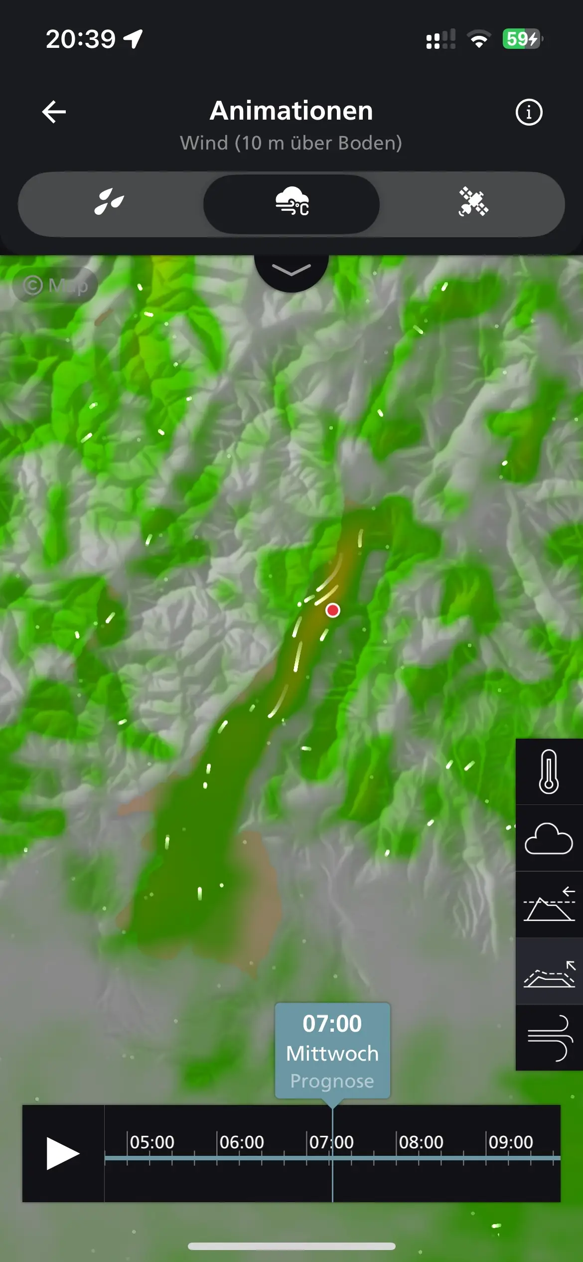
look like on the App.
With friendly permission of Meteoswiss
Wind forecasts from Windfinder, Windguru, Windy, etc. never predict good wind for Lake Garda as their forecast models aren’t suited to the lake’s thermal winds. Please ignore them!


How is the weather?
We recommend focusing on the rain radar forecast for the current day. Any forecast predicting weather more than one day ahead is, quite simply, guesswork.

Bad weather forecasts for Lake Garda should not be taken too seriously—around 90% of the time when bad weather is predicted, we still enjoy good conditions on the Lake.
Many forecasts don’t account for the unique microclimate of Lake Garda. It’s common to see dark clouds over the surrounding mountains while the Lake itself stays sunny and clear. Even if a quick shower passes, the sun usually returns within 30 minutes—along with the wind and good mood. Trust us, Lake Garda’s weather is often much better than it looks on the apps!